

Saturday, September 25, 2010
Monday, May 25, 2009
"Tunganath" -The Highest Temple of the world.

Tunganath is one of the 5 Shiva shrines, the Panchkedar. Panch – means 5 and pronounced as punch; Kedar – name of Hindu God Lord Shiva and pronounced as Kay-daar. The  other 4 are Kedarnath, Madhmaheshwar, Rudranath, and Kalpanath.
At the Panchkedar the worshipped stone or image is considered a manifestation of Lord Shiva’s various body parts. At Kedarnath the rump is visible, at Madmaheshwar his navel or belly, the face at Rudranath, the hair (locks) at Kalpeshwar and his arms at Tunganath. All of these Temples were supposedly built at the behest of Adi Shankaracharya.
Tungnath (altitude of 3,886 meters) is the highest temple in the world. Legend has it that the arm of Shiva appeared here. Ravana, of the Ramayana, is said to have performed penance at this temple to propitiate Shiva. The high altitude temple is a Seat of Swyambhu Linga or the Lord Shiva Incarnate. The temple, one of the Panchakedars or one of the five Shiva temples, is situated in Chamoli district of the Uttarakhand region. The mythology has it that Lord Shiva was enraged at the act of homicide enacted by the Pandavas by killing their brethren in the grand battle of Mahabharata. Aware of Shiva's annoyance, the Pandavas built the temple to please Lord Shiva and for their own salvation. Others claim that the Adi Shankaracharya during his historic visit to the region had got it built. The cite the presence of Adi Shankaracharya's image in the garbha-griha or the sanctum of the temple. However, it also houses images of the Pandavas. Besides, the ashtadhatu images of Kaal Bhairava and Veda Vyasa are among the multitude of images there. A dark left-tilting one-foot high linga is the centre of attraction. The locals describe it as an arm of Lord Shiva.
How To Reach
Chopta is the gate way of Tunganath. Rishikesh - Ukhimath 180 kms Drive. From Ukhimath to Chopta another 35 km. Nearly 4 Kms Trek to Tunganath starts from here. Chandrashila peak is another 1 km trek from Tunganath. one can climb the chandrashila peak from Tungnath as it is in the same feature and can be reached in about an hour's time The peak provides a rare panoramic view of innumerable snow peak. The trek passes through forests of Rhododendron and alpine meadows. If heading towards Ukhimath one should not miss Deoriatal, now jeepable from Mastura.
 It is a small deep lake at an altitude of 2440m. In early morning, the snowy ranges including Chaukhamba and Kedarnath is clearly reflected on the water; an unforgettable sight.

Thursday, May 14, 2009
Sandakphu-Phalut Trek way to paradise.
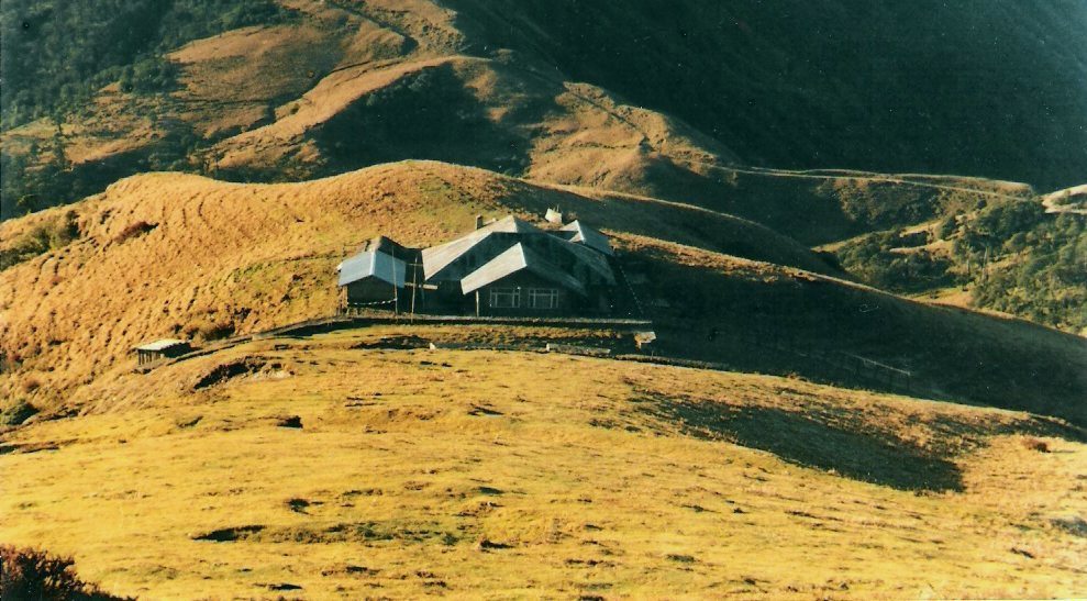
The Sandakphu is the culminating point of many trekking routes in the Darjeeling-Sikkim region.
At an altitude of 3,636 m, it is located at a distance of 58 km. from Darjeeling. Maneybhanjan, at an altitude of 2134 m., is the gateway to the Sandakphu-Phalut region. Trek to Sandakphu starts from Maneybhanjan, a small town. - can be reached from Siliguri via Ghoom or via Mirik.
Sandakphu - Phaloot is the Paradise of Trekkers. Sandakphu & Phalut is a vantage point from where one can see four of the world's five highest peaks - Everest, Kanchenjunga, Makalu and Lhotse in a continuous snow-clad arc.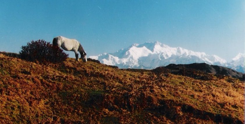
Sandakphu is resplendent with the ethereal beauty of magnolias, rhododendrons, primulas and other sub-alpine flowers. It also contains more than 600 varieties of orchids. Sandakphu may be visited at any time of the year. The monsoon months of July-August is not suggested. Phalut may be avoided in winter.
Description of the trek to Sandakphu
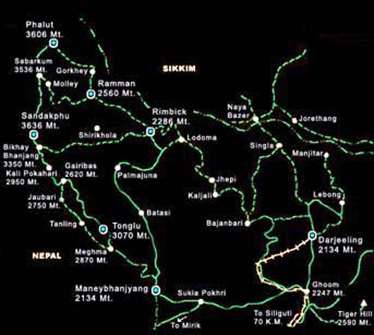
The first lap till Chitre passes quite steeply uphill on a good stoned path through lush greenery of pine, fir, birch forests and bamboo glades. It takes about an hour and half to reach Chitre (2530 m). Crossing the Buddhist settlement of Chitre reach Meghma. The trail bifurcates at Meghma. The right uphill route leads to the trekkers hut at Tonglu (3070m) in India. The trail in the left passes through Nepal. The roads meet again at Tumling (in Nepal).
Tonglu is famous for the view of the snow-capped peaks of the Singalila range and the Kanchenjunga range. Tumling on the other hand is a salubrious night halt with assorted lodges dotting its sedate green environs. The lights of the towns of Darjeeling, Kurseong, Pasupati, Siliguri and other settlements can be viewed in a clear night.
The next day's trek from Tonglu or Tumling is rewarded with a wide variety of flora, fauna and avifauna as you enter the Singalila National Park. The trek route passes through the Indo-Nepal border. The area is also the house of wide varieties of Rhododendron and the playing ground of Red Pandas. Reach Goiribans (9 km. 2621 m) through Joubari (in Nepal). After some break move on to second nights halt at Kalepokhri (4 km from Goiribans, 3108 m, in Nepal). The trek from Tumling to Kalepokhri takes about 5 hours. At Kalepokhri there is a small crystal lake surrounded by pine trees and prayer flags. The dark color of the water in the lake leads to the name of Kalepokhri (Kale = Black & Pokhri = Lake).
As the third day of trek unfolds, you realise that Sandakphu is within a short striking distance now (9 km app) leaving behind Bikevanjan(5 Km from Kalepokhri). But hold your breath. You will be negotiating with an uphill climb today. After a tough trek will leave you panting and gasping, you will reach Sandakphu (3636m), the highest point in West Bengal. As soon as you reach Sandakphu, you will realise why it is called the paradise of trekkers. The views of four of the five highest peaks in the world.... Everest, Kanchendzonga, Makalu and Lhotse along with numerous other snow capped peaks great us in the morning. A day's halt at Sandakphu allows trekkers to view the surroundings.
From Sandakphu there are several trekking options available to the tourists. You can go down to Rimbik directly by a shortcut route through dense forests via gurdum & Sreeekhola.
Phalut (3600m) 27Km from Sandakphu leaving behind Sabargram. From Phalut you can go Three ways. One is going down to Rimbik via Sabargram & Molley, another is Going down to Rimbik via Gorkey & Rammam. Rimbik is the road head on the other side of the trek. From here you will be taken to your next destination. With the Third way you can reach utture at Sikkim by crossing the Singalila Pass.
Trek path of Sandakphu - Phalut
Sunday, May 10, 2009
Om Parvat

Om Parvat is an ancient holy mountain range, lying in the Pithoragarh district of Uttarakhand, India, near Sinla Pass.
Its snow deposition pattern gives the impression of the Hindu sacred syllable 'AUM' (ॐ) written on it. Near Om Parvat lie Parvati Lake and Jonglingkong Lake. Jonglingkong Lake is sacred, like Mansarovar, to the Hindus. Opposite to this peak is a mountain called Parwati Muhar, whose snow shines like a crown in the sun.
Climbing OverviewThis peak was attempted for the first time by an Indo-British team including Martin Moran, T. Rankin, M. Singh, S. Ward, A. Williams and R. Ausden. The climbers promised not to ascend the final 10 metres (30 ft) out of respect for the peak's holy status. However, they were stopped around 200 m (660 ft) short of the summit by very loose snow and rock conditions.
The first ascent of Adi Kailash came on October 8, 2004. The team comprised Tim Woodward, Jack Pearse, Andy Perkins (UK); Jason Hubert, Martin Welch, Diarmid Hearns, Amanda George (Scotland); and Paul Zuchowski (USA). They did not ascend the final few metres, again out of respect for the sacred nature of the summit.
Om Parvat can be viewed en route to the Kailash Manasarovar Yatra from the last camp below Lipu Lekh pass at Nabhidhang. Many trekkers to Adi Kailash often make a diversion to view Om Parvat.


Parvati Tal
Trekking Overview
ADI-KAILASH (CHHOTA KAILASH) OM PARVAT
Trekking to Adi Kailash in the Himalayan ranges of Kumaun region near the Indo Tibetan Border in district Pithoragarh.
Upto Gunji the route is same. One walks 14 km, first to the left of Kuti and then to the right, to reach Jollingkong (4572 m).


Location from Base Camp
Dharchula Altitude 4700 mtrs. (15510 ft.)
Camps Pangu, Sirkha,
Gala, Budhi,
Gunji, Kuti,
Jollingkong, Adi
Kailash


Chhota Kailas from Sinla Pass


Chota Kailash


Wednesday, May 6, 2009
Car of James Bond 007
James Bond has probably driven more different vehicles than any handful of other screen characters in cinema history. From the Sixties cool of a Sunbeam Alpine and Aston Martin, through the Seventies and Eighties with svelte Lotus Esprits, to the Nineties chic of BMW sportscars, and speeding into the 21st Century with Aston Martin’s beast of a car – the Vanquish. Take a look at the files of just a few of the cars in which James Bond oo7 has created more screen destruction, havoc, mayhem.
Have a look at some of the Car which have used by 007.
------------------------------------------------------------


Aston Martin DB5 - Goldfinger


Lotus Esprit - The Spy Who Loved Me
 Lotus Esprit Turbo - For Your Eyes Only

 Aston Martin V8 Vantage and Volante
The Living Daylights.


BMW Z3 - GoldenEye BMW 750iL - Tomorrow Never Dies


BMW Z8 - The World Is Not Enough


Aston Martin V12 Vanquish - Die Another Day

Aston Martin DBS - Casino Royale and Quantum Of Solace
Tuesday, May 5, 2009
McLeod Ganj The Home towm of Great Dalai Lama.
McLeod Ganj or Mcleodganj, also known as Upper Dharamsala is a suburb of Dharamsala in Kangra district of Himachal Pradesh, India. It is known as "Little Lhasa" due to its large population of Tibetans.
| mcLeod Ganj Himachal Pradesh • India | |
| Nickname: Little Lhasa | |
   | |
| Coordinates: 32°15′N 76°19′E / 32.25, 76.32 | |
| Area • Elevation | • 2,082 m (6,831 ft) |

McLeod Ganj is named after David McLeod, the Lieutenant Governor of Punjab.During the British rule in India, the town was a hill station, where the British people spent hot summers.

In 1959, Tenzin Gyatso, 14th Dalai Lama was offered refuge in McLeod Ganj when he fled to India after the failed uprising in Tibet lead by his brother against the Communist Party.

Himalayan View, McLeod Ganj.
===========================================================
TransportThe nearest airport is Gaggal Airport, near Kangra. The nearest narrow gauge railway stations are Kangra and Nagrota. The nearest broad gauge railhead is Pathankot. The town is connected by road to Delhi the capital of India and major cities of Himachal Pradesh.
Place to Visit
The most important Buddhist site in the town is Tsuglagkhang or Tsuglag Khang, the Dalai Lama's temple. It has statues of Shakyamuni, Avalokiteśvara, and a statue of Padmasambhava (Guru Rinpoche).
Other Buddhist and Tibetan sites in McLeod Ganj include the Namgyal Monastery, the Tibetan Institute of Performing Arts. Gompa Dip Tse-Chok Ling (a small monastery), the Library of Tibetan Works and Archives, Gangchen Kyishong, Mani Lakhang Stupa, Nechung Monastery, Norbulingka Institute,
===========================================================
Other placesThe major tourist centers near McLeodganj include Dharamsala, Palampur, Kangra, Tatwani and Machhrial. Other tourist spots include:
TriundA tourist spot on on the foothills of Dhauladhar range, located 9 km from Mcleod Ganj St. John in the WildernessAn Anglican church located in the forest near Forsyth Gunj. The neo-Gothic stone building of the Church was constructed in 1852. The site also has a memorial of the British Viceroy Lord Elgin, and an old graveyard. The Church building is also noted for its Belgian stained-glass windows donated by Lady Elgin. BhagsuA small village that is now almost a part of Mcleodganj, Bhagsu is about 15-20 minutes of a walk from Mcleod. It has plenty of small cafes and diners that serve pretty good food actually. Beware of the spurious and ubiquitous alternative healing and cooking classes that you might be tempted to try.Strongly recommended is a visit to the community pool besides an ancient temple and the waterfall.When at the waterfall, follow the painted signs and trek about 15 minutes up the mountain to Shiva Cafe. Is you're a marijuana aficionado, it is recommended that you buy your own hash before heading over to Shiva Cafe - all said and done, its a wonderful place to enjoy a taste of Himalayan nature and calm. Dal LakeA scenic lake, located around three km from McLeod Ganj, next to the Tibetan Children's Village. An annual fair is held here in August-September, and is attended mainly by the Girths and the Gurkhas.
===========================================================
Subscribe to:
Posts (Atom)


